The Butte Fire
Two days from a power line in Amador County to this hillside. Everything here is inside the burn scar.
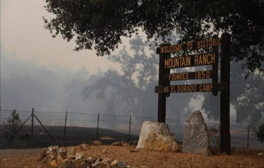
Mountain Ranch while it was burning, September 2015. Photo: Unknown / Social Media (2015 Butte Fire). Used under Fair Use for commentary.
Where it started
A tree came into contact with a Pacific Gas and Electric power line near Butte Mountain Road, in Amador County, at 2:26 in the afternoon on September 9, 2015. The ignition point was about three and a half miles southeast of Jackson. CAL FIRE investigators announced that finding on April 28, 2016, seven months after the fire went out.
The name catches people out. The fire is named for Butte Mountain Road, where it started, and not for Butte County, which is a different place well to the north.
Two days
The first afternoon it looked like a fire that would be caught. It was reported at a hundred and sixty acres, and by that evening it was being called thirty percent contained.
The next morning it ran, and the morning after that it ran again. September 10 took about 25,000 acres. September 11 took about 29,000 more. Both runs went south and up the drainages: North Fork Calaveras Creek, Jesus Maria Creek, Salamander Creek.
By three in the afternoon on September 11 it had burned 50,000 acres in the forty-six hours since it started.
Those are the creeks that come into Mountain Ranch, and this land sits among them. The fire reached here on September 11, two days after a tree touched a wire in another county. Yggdrasil Springs is inside the burn scar, all eighty acres of it.
| | |
|---|---|
| September 9, 2:26 pm | ignition, near Butte Mountain Road |
| September 9, evening | 160 acres, called thirty percent contained |
| September 10 | about 25,000 acres burned in one day |
| September 11, morning | 31,974 acres |
| September 11, 3 pm | 50,000 acres, forty-six hours in |
| September 11, evening | about 64,700 acres |
| September 14 | about 71,500 acres |
| October 1, evening | contained, 70,868 acres |
The final figure is lower than the peak because a perimeter gets re-flown and redrawn as the mapping improves, and not because any of it came back.
What it took
By the morning of September 15 the fire stood at 71,660 acres and 37 percent containment, and the count working it was 4,668 people and 516 engines.
With them that morning: 117 dozers, 82 hand crews, 18 helicopters, 8 airtankers and 58 water tenders.
That is one morning's tally and not a total. Containment was still more than two weeks away.
What it cost
70,868 acres. 921 structures: 549 homes, 368 outbuildings and four commercial buildings. The fire claimed two lives. One of them close to us.
About 59,000 of those acres were private land. About 12,000 belonged to the Bureau of Land Management.
Counts differ by what is being counted and by when it was counted. The watershed report, written that October while the assessment was still running, gives 475 residences and 343 outbuildings. CAL FIRE's list of the twenty most destructive counts 965 structures, taking in minor ones as well. The 921 is the finished damage assessment, which is why it breaks down into homes, outbuildings and commercial.
When it was contained it was reported as about the seventh or eighth most destructive fire in California history, with the Valley Fire from the same month sitting just above it. By October 2022 it had fallen to eighteenth on CAL FIRE's list, and it has kept sliding since. That is a fact about the decade California has had rather than about this fire.
The ground had mostly never burned in the record. Thirty fires are recorded inside the perimeter and all of them except two were under 1,700 acres. The Jesus Maria Creek and North Fork Calaveras watersheds, and most of Salamander Creek, had virtually no recorded fire history at all. The fuel had been building for longer than the records go back.
What was not rebuilt
Most of those homes never came back.
The lots are still here. Cleared ground, a driveway, a well, and no house on any of it, and they are an ordinary part of the view on the roads around Mountain Ranch. Rebuilding meant felling burnt trees before anything could be framed, drilling a new well, and finding the money with insurance written to a figure set years earlier and a settlement with the power company that took years to arrive. Plenty of people sold the bare parcel and moved to San Andreas or Angels Camp or out of the county.
The county wrote it into its own housing plan. Between 2010 and 2018 Calaveras County's stock of single-family homes fell by more than 260, and the plan puts that down to the fire and the five hundred and more units it took. Four years on, the same plan was still recording residents displaced by the fire, and older people who did not want to rebuild a single-family house and had nowhere else to go.
The census will not show it. Mountain Ranch was redrawn between the 2010 and 2020 counts, from 41 square miles to under 4, so its two population figures do not describe the same ground. The towns that kept their boundaries held their numbers or grew across those same years. What emptied was the ground that burned.
What came back
All of this ground burned, and eleven years on it does not read as a burn from any distance.
Golden fleece came up through the burn and is now one of the commonest shrubs on the land. Black oaks that burned to the ground pushed new stems out of the root crown and are trees again. Manzanita and buckbrush came back from seed that needed the heat to open.
The standing dead are still standing. They are the grey trunks on the ridges in almost every photograph on the site, and they will be there for years yet. Taking fuel off this land is why the work here exists.
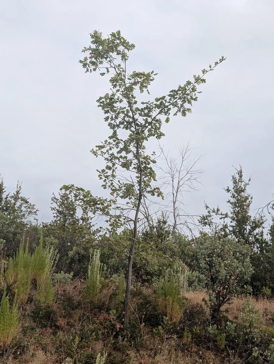
A black oak back from the root crown, with one of the standing dead behind it. August 28, 2026.
The books
Three books tell it from the inside. Two are one person's account, by an author who was evacuated off her own ranch with fifteen minutes to load: the evacuation as it happened, and the years that followed. The third is the county's own, and it has more than fifty people in it.
Nancy Morgan Reed. Fifteen minutes to load the animals, and then the horses loose in thousands of acres of wilderness and found down in the river gorge.
Nancy Morgan Reed. The follow-up, and the harder book: a week-by-week journal from re-population to the settlement with the power company two and a half years later.
An anthology from Manzanita Writers Press, the nonprofit literary press in Calaveras County. Stories, poems and photographs from more than fifty people who were in it, in Mountain Ranch and the towns either side. Monika Rose, the press's founding editor, is one of them.
And a song
Lee Davis, from the album Ribbon of Time. Written locally and released in June 2025, a decade after the fire it is about.
Where the numbers come from
The determination, announced April 28, 2016: contact between a tree and a PG&E powerline near Butte Mountain Road.
Where the day-by-day spread, the acreage, the ownership split and the fire history of the ground all come from. Written for the watershed rather than for the news.
The county's own account of what the fire did to its housing. More than 260 single-family homes gone from the stock between 2010 and 2018, and residents still displaced by it four years on.
Where the 965 structures and the ranking come from. The list is kept current, so the Butte Fire sits lower on it now than the eighteenth place it held in October 2022.
Where the people and the equipment come from. The incident's own resource count, printed in full, alongside the evacuation lines and the road closures as they stood that Tuesday.
Where the forty-six hours comes from, and the satellite heat maps timed to the small hours and the afternoon of September 11 that show how far south it had come by then.
Acreage and containment as they were reported each day through September 2015.
Reported September 18, 2015. Neighbors put themselves between the fire and the town and stopped it going through.